
Instruction manual:
Sound on!
Use if possible headphones!
You may start the episodes individually or simultaneously
Best use in the subway, trains, airports, a park, wherever...
'Die Insel' feat. Canadian dancer, actress and performer Stephanie Cumming
Episode I – Lost Islands
Note: Start Video und Audio File beneath simultaneously!
Bermeja A.D. 1539
Discovered in the early 16th century by Spain, but mysteriously vanished sometime during the 17th century. While no dominant theory holds, it is possible that the island submerged due to tectonic movements, supported by the existence of a seamount and the nearby Scorpion Reef.
Brasil 1325
Said to lie in the Atlantic Ocean west of Ireland. Irish myths described it as cloaked in mist except for one day every seven years, when it became visible but still could not be reached. Several 16th century maps showing the island of Brasil also showed an island labelled Demar further south-west.
Davis Land 1687
At the time, it was believed that gold could be found elsewhere along the latitude so several navigators were instructed to seek it out on their voyages. Never found, it was also believed to be the coast of Australia
Jacquet Island
An island just to the east of the Flemish Cap; it was believed to exist into the 19th century, during which cartographers discussed it as a possible midway point for the Transatlantic telegraph cable.
Keenan Land
Large landmass reportedly discovered in the Arctic north of Alaska; numerous searches failed to relocate it.
Kentzell’s Island
Reported by Capt. Kentzell of San Francisco at approx. 40° N, 150° 30′ W. The island, 20 miles long and „very low,“ was said to have a large seal and sea elephant population, and therefore was kept secret by seal hunters. Searches failed to find it while sightings still came in.
Tiburones
The residents of Uapoa claimed it existed, reporting it had high land, one sandy beach which could be approached in good weather, and a single male inhabitant – the others having fled. Location given as 11° S, 143° W; noted doubtful in 1851 and not seen on modern maps.
Yosemite Rock
Noted as „Existence doubtful“ in Operational Navigation Chart of the United States Department of Defense.
L’Enfants Perdu Islands
Found doubtful in 1875 after searches found no land in the area. Possibly a mistaken sighting of the Horne Islands.
The Isle of Demons [https://en.wikipedia.org/wiki/Isle_of_Demons]
Is a phantom island once associated with Quirpon Island, Newfoundland in Canada. It was generally shown as two islands. It began appearing on maps in the beginning of the 16th century and disappeared in the mid-17th century
The Isle of Demons continues to appear as late as the 1556 map of „La Nueva Francia“ by Giacomo Gastaldi. The „Isola de Demoni“ is depicted by Gastaldi as a substantially large island roughly encompassing northern Newfoundland, with figurative depictions of flying demons.
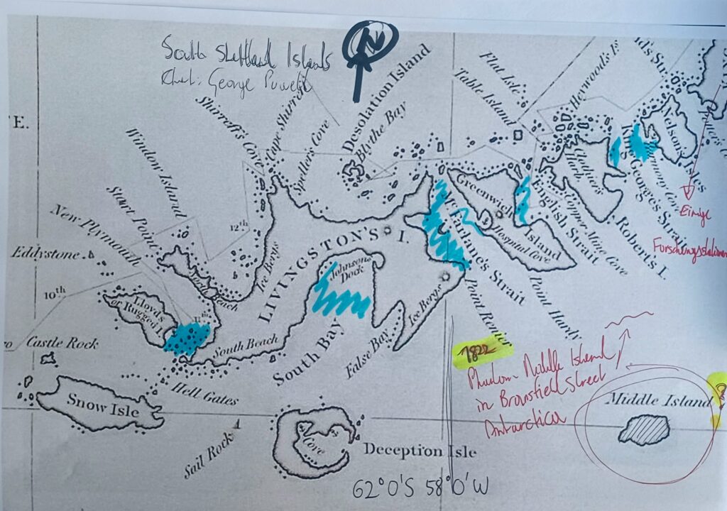
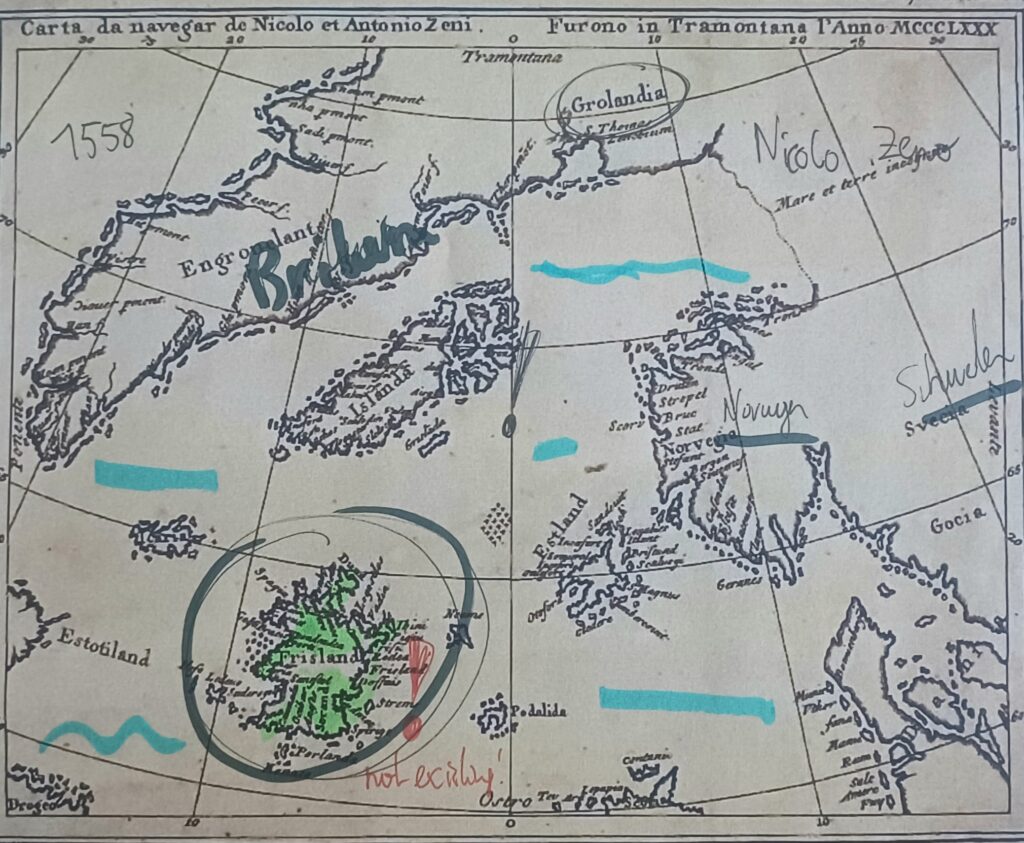
[Map beneath] The Zeno brothers, Nicolo ans Antonio, came to prominence in 1558 when their descendant, Nicolo Zeno the younger, published a map and a series of letters purporting to describe an exploration made by the brothers of the north Atlantic and Arctic waters in the 1390s.
Modern historians and geographers have disputed the veracity of the map and the described voyages, with some accusing the younger Zeno of forgery.
The Zeno Map showing Frisland – a phantom island in the North Atlantic
Phantom island | Island studies [Nissology] | Lost lands